The easiest way to see them is to start with the Lake Havasu Lighthouse Club's current map. Some are easy to approach on foot or by car; others are better from the water. Use the live map instead of chasing an old checklist.
Why Lake Havasu has lighthouses
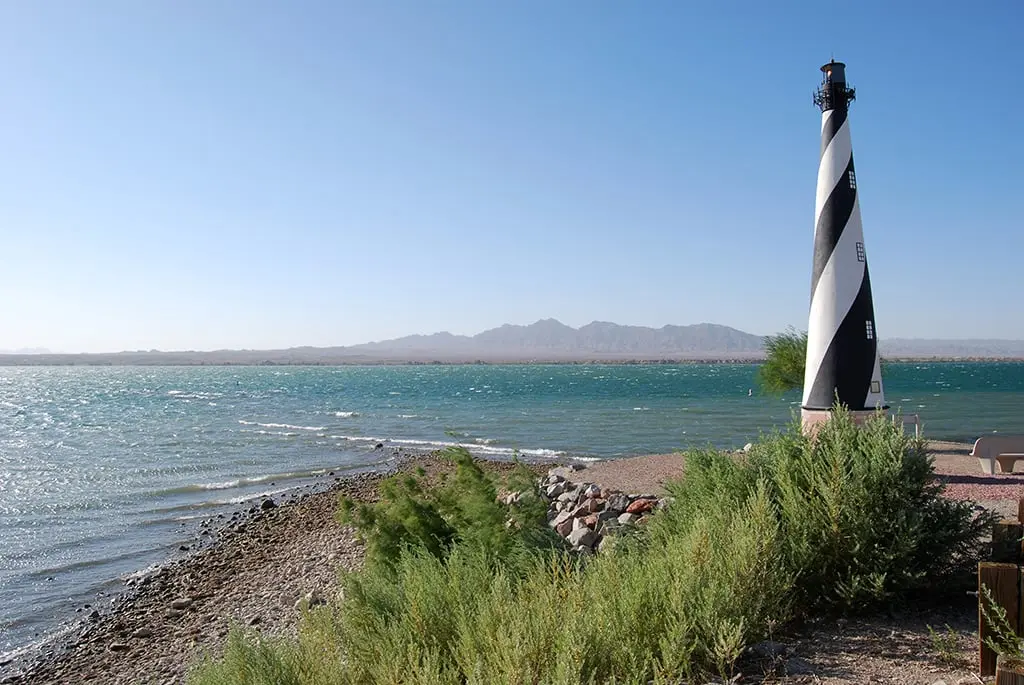
The Lake Havasu Lighthouse Club is a nonprofit group that installs and maintains the replicas as real aids to navigation. Their familiar shapes and flashing lights mark shoreline features while also creating one of the lake's most distinctive local projects.
Each structure is modeled after a named lighthouse, but the Lake Havasu versions are reduced-scale replicas. Treat the club's official list as the authority for names, coordinates and current status.
The replicas are not arranged like a walk-through museum. They are spread around a working shoreline, so the useful question is not just how many exist—it is which group can be seen legally and comfortably from the land or water route you already plan to use.
Build a lighthouse route you can enjoy
Do not plan to see every lighthouse in one casual stop. First choose whether you are sightseeing by car and foot, by rented boat, or on a narrated cruise. Then group locations by shoreline area using the club map.
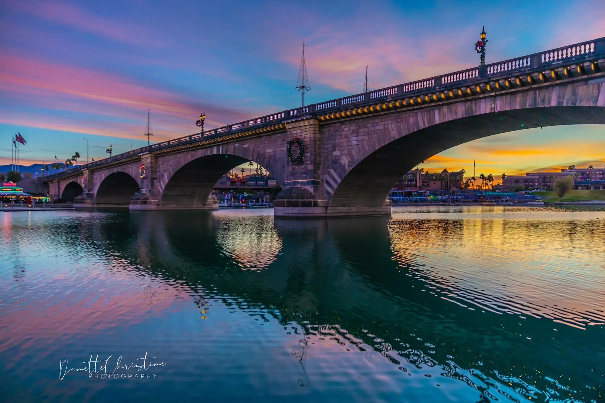
For a land-based outing, combine only clearly accessible locations with nearby stops such as London Bridge, Rotary Community Park or the Grand Island Loop. Never cross private property or scramble over unstable shoreline to reach a marker.
A good land route focuses on a few accessible replicas instead of chasing every pin. Check the club map, group nearby stops, and leave room for parking and shoreline access; a lighthouse visible on the map may still sit across water or behind a route that is not practical on foot.
Seeing the replicas from the water
A boat gives the broadest viewing range, but the operator still needs to follow navigation markers, no-wake areas and current Arizona boating rules. A lighthouse is a navigation aid, not permission to beach or tie up nearby.
Visitors who do not want to operate a boat can ask current Lake Havasu boat tour operators which lighthouse route they run. Tour routes are weather- and operator-dependent, so confirm the itinerary before booking.
From a boat, the replicas work best as part of a larger route through the Channel or along the shoreline. Give the captain or rental operator the lighthouse names you care about and ask whether water level, wind and the planned itinerary make those stops realistic that day.
Photography and respectful access
Morning and late-day light often gives the shoreline more shape and reduces the harsh midday contrast. Use a longer lens when a replica is best viewed across water, and keep launch ramps, docks and navigation channels clear while taking photographs.
Conditions around the lake change with weather, water level, construction and events. If the official map and onsite access do not agree, follow posted restrictions.
Use a longer lens instead of stepping onto rocks, landscaped areas or private property for a closer photograph. Early and late light adds shape to the towers, but low sun also makes footing and boat traffic harder to read, so stop somewhere safe before composing the shot.
Make the plan work
Build a lighthouse route that fits the day
Lake Havasu’s lighthouse collection is more enjoyable as a scavenger hunt than a count-the-whole-list challenge. Choose a viewing method first, then let the official map show which replicas make sense along that route.
Start with the live map
Use the Lighthouse Club map to identify current replicas and their shoreline positions. Screenshot the small group you want to find so the outing still works when cell service is weak.
Open the official lighthouse mapChoose land or water
Land viewing costs less and fits a casual afternoon; a boat can reach a broader shoreline. Do not assume a road pin means public walk-up access, and do not assume every cruise follows a lighthouse route.
Compare captain-operated boat toursAdd one nearby anchor
Pair the search with London Bridge, Bridgewater Channel or a sunset cruise instead of building the entire day around scattered markers. That gives the outing a clear start and finish even if one replica is hard to view.
Plan a London Bridge stopCheck the day, not the monthly average
Lake Havasu City weather
Heat and wind can change the safest time, route and backup plan. Check the live Lake Havasu forecast here, then use the managing agency or operator for closures, launch conditions and activity-specific rules.
Read how hot Lake Havasu gets in summer
Your question, answered
Replica Lighthouses frequently asked questions
Are the Lake Havasu lighthouses real?
They are reduced-scale replicas, but they also operate as navigational aids maintained by the Lake Havasu Lighthouse Club.
Can I see the lighthouses without a boat?
Yes, several can be viewed from public land. Others are easier to see from the water, so use the official map to choose a land-based route.
How many replica lighthouses are there?
The project changes over time. Use the Lighthouse Club's current map and list instead of relying on a fixed count from an older article.
Is there a guided lighthouse tour?
Some boat-tour itineraries feature lighthouse replicas. Routes vary, so ask the operator exactly what the current trip includes.
Check before you go
Current details from the source